Strovolos (Stróvolos)
Strovolos (Στρόβολος; Strovolos; Ստրովոլոս) is a municipality of Nicosia District. With a population of nearly 70,000, it is the second most populated municipality in Cyprus, after Limassol, and the most populated municipality of Nicosia District. It was established in 1986.
Strovolos is now a town covering 25 km2 divided into six parishes: Chryseleousa, Ayios Demetrios, Apostolos Varnavas kai Ayios Makarios, Ayios Vasilios, National Martyr Kyprianos and Stavros.
The name Strovolos is said to originate from the Greek word "strovilos" (Στρόβιλος) as in "anemo-strovilos" which means whirlwind or twister. There are references to Strovolos or Strovilos as early as the Middle Ages from the well-known medieval chronicler Leontios Makhairas, and from Florius Boustronius a little later. According to these sources, Strovolos was a royal field during the years of Frankish Rule. A major and definitive figure in the history of Strovolos was the National Martyr, Archbishop Kyprianos, who before the 1821 Revolution in Greece, contributed greatly to the preservation of the Greek spirit and Christianity. The Turks hanged Archbishop Kyprianos and other high priests and dignitaries of Cyprus on 9 July 1821.
Strovolos evolved into its present form after the events of 1974, when Turkey invaded Cyprus and occupied 38% of the island’s territory. This led to the settlement of many refugees within the Municipality.
The Chryseleousa parish was named after the Greek orthodox church of the same name that was built around the 12th Century.
Map - Strovolos (Stróvolos)
Map
Country - Cyprus
 |
 |
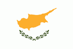
| Flag of Cyprus | |
The earliest known human activity on the island dates to around the 10th millennium BC. Archaeological remains include the well-preserved ruins from the Hellenistic period such as Salamis and Kourion, and Cyprus is home to some of the oldest water wells in the world. Cyprus was settled by Mycenaean Greeks in two waves in the 2nd millennium BC. As a strategic location in the Eastern Mediterranean, it was subsequently occupied by several major powers, including the empires of the Assyrians, Egyptians and Persians, from whom the island was seized in 333 BC by Alexander the Great. Subsequent rule by Ptolemaic Egypt, the Classical and Eastern Roman Empire, Arab caliphates for a short period, the French Lusignan dynasty and the Venetians was followed by over three centuries of Ottoman rule between 1571 and 1878 (de jure until 1914).
Currency / Language
| ISO | Currency | Symbol | Significant figures |
|---|---|---|---|
| EUR | Euro | € | 2 |
| ISO | Language |
|---|---|
| EN | English language |
| EL | Greek language |
| TR | Turkish language |


